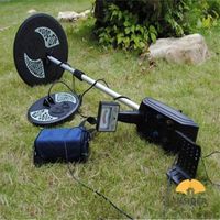
COMPLETE RANGE FOR SURVEYING GPR
-
Supplier: Shenzhen Pengjin Technology Co., Ltd. -
Region: Guangdong, China -
Contact: Mr PJ Manager -
Price: $3500.00 /set -
Min. Order: 1 set
| Place of Origin: | United Kingdom; | Sensor Frequency: | 250MHZ Ultra Wide Band; |
| Depths range: | Up to 8m (27') maximum; | Signal Enhancement: | DynaQ (optimizes data quality with cart speed).spatial filting.; |
| Payment Terms: | L/C,T/T,Western Union; | Supply Ability: | 1 Unit/Units per Week; |
| Languages supported: | Non-lingual icons,English, Spaish, French, German; | Packaging Detail: | size:100 x 70 x 115cm (39.4 x 27.6 x 45.3") weight: 30kg; |
| Power: | Consumption: 1025V Battery: 12V,9AH Lead Acid; | Data Analysis: | In field analysis; |
| Spatial interval: | 5 cm (2''); | Delivery Detail: | 3-5days; |
| Port: | HONGKONG OR SHENZHEN; | Model Number: | RD8100; |
| Dispaly depths scale: | 1m-8m (3'-30'); | Touch Screen Display: | Size:21cm (8'') diagonal; |
| Brand Name: | SPX; | Compliance: | CE,FCC,ETSI,Industry Canada; |
Complete range of utility-locating radars
Radiodetection’s
RD1100 & RD1500
Ground Penetrating Radar
Geo-referenced data
Display the position of your surveys in Google Earth™ and other geo-referencing programs.
Screen captures
Add markers via the touch screen display to highlight features of interest.
Depth Slices (RD1500)
View horizontal slices at different depths to display cables, pipes and other utilities in unprecedented clarity.
On-site Map View (RD1500)
View your identified features in plan map view using the optional external GPS.
Innovative tools for finding buried utilities
Radiodetection's RD1100&RD1500 ground penetrating radar is an innovative tools for finding buried utilities.
RD1100 provides locate professionals, surveyors and other users with the tool they need to trace and mark the position of all types of cable and pipe, including plastic and ceramic. Built in as standard is the ability to take Screenshots which are saved to internal memory for immediate emailing via Wi-Fi or later export to USB memory stick. GPS positioning is captured for integration into Google Earth.
RD1500 takes utility locating to the next level, offering users easily interpreted Depth Slices as well as traditional Line Views.Use proprietary FrequenSee™ technology to highlight small/shallow, medium or large/deep buried utilities. Enhance the RD1500 with software to export GPR data and perform detailed analysis, and with external GPS for higher positional accuracy.
Main Features
1) Geo-referenced data,display the position of your surveys in Google Earth™ and other geo-referencing programs.
2) Screen captures,add markers via the touch screen display to highlight features of interest
3) Depth Slices (RD1500),view horizontal slices at different depths to display cables, pipes and other utilities in unprecedented clarity.
4) On-site Map View (RD1500),view your identified features in plan map view using the optional external GPS.
5) Instant email,generate and deliver mini reports from your survey site by connecting to a Wi-Fi network or by using your phone as a hotspot.
Geo-referenced data
Name: RD1100&RD1500 ground penetrating radar
Brand: SPX
Original: UK
Display the position of your surveys in Google Earth™ and other geo-referencing programs.
Screen captures
Name: RD1100&RD1500 ground penetrating radar
Brand: SPX
Original: UK
Domestic famous engines, strong driving force, low fuel consumption, high economic benefits 12F+4R sliding sleeve shift.
Depth Slices (RD1500)
Name: RD1100&RD1500 ground penetrating radar
Brand: SPX
Original: UK
View horizontal slices at different depths to display cables, pipes and other utilities in unprecedented clarity.
On-site Map View (RD1500)
Name: RD1100&RD1500 ground penetrating radar
Brand: SPX
Original: UK
View your identified features in plan map view using the optional external GPS.
Pre-Sales Service
* Inquiry and consulting support. .
* Visiting our company website.
After-Sales Service
* Training how to instal the machine, training how to use the machine.
* Engineers available to service machinery overseas.
-
MD5008 3-5M depth metal detector dual probe plate gold silver copper metal hunter

-
2022 Hot Selling Metal Detector Gold Detector GP Pointer Accurate Positioning Handheld Metal Detector

-
DETETOR GPZ 7000 GOLD cheap for sale

-
Original Titan GER 1000 Device 5 System Underground Gold Metal and Cheap Treasure

-
Wholesale Original GER Detect Titan 1000 Metal Detector 3D 5 Multi System Deep

-
Lowest Price Handheld Metal Detector Professional Pointer Big Promotion Metal Detector Locator Detector PIN POINTER Accurate Positioning

-
Genuine Underground Minelab GPZ 7000 Gold Metal Detector

-
Hot selling underground metal detector GC1028 treasure detector mining non-ferrous metal gold mine archaeological detector

-
Factory Price Handheld Professional Gold Treasure Hunter Pointer Metal Detector

-
MD5008 3-5M Deep Gold Metal Detector Double Detector Gold, Silver and Copper Metal Hunter

Other Products
-
 $2500.00 - $3500.00 / unit
 -
 $3000.00 / unit
 -
 $2500.00 / unit
 -
 $5800.00 / set


